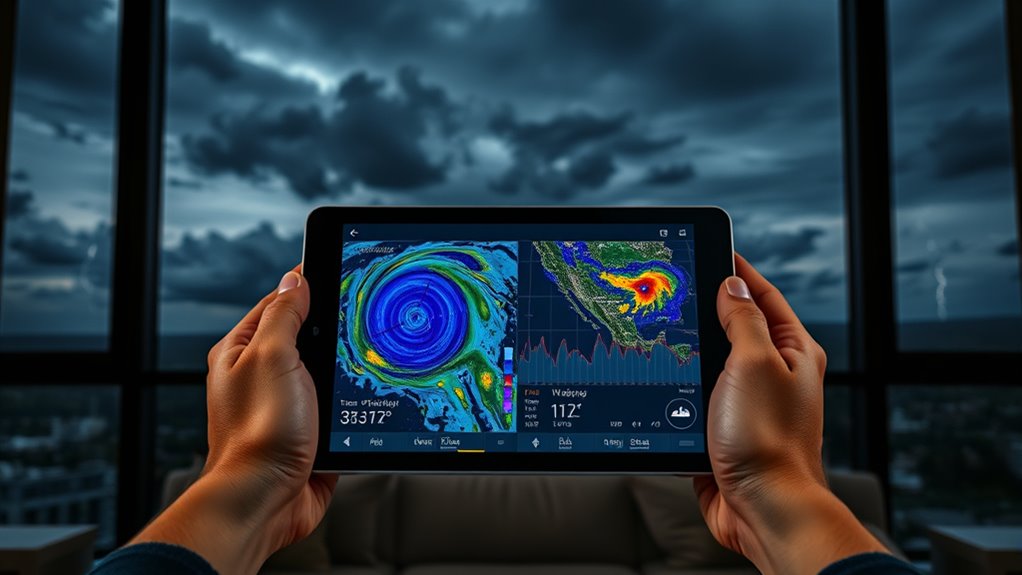
To spot weather windows, you should closely monitor forecasts and radar images. Use reliable weather apps or online tools to visualize approaching systems and track storm movement. Recognize patterns like high-pressure systems for clear days or cold fronts signaling storms. Comparing radar data with forecasts helps confirm if conditions are suitable for outdoor activities. Mastering these tools and techniques can help you plan better—if you keep exploring, you’ll discover how to use them more effectively.
Key Takeaways
- Use reliable weather apps and radar tools to visualize approaching weather systems in real-time.
- Monitor forecast updates regularly to identify stable periods suitable for outdoor activities.
- Track storm movement with radar to determine if severe weather is passing or imminent.
- Recognize weather patterns like high-pressure systems for clear, stable conditions.
- Correlate forecast predictions with radar data to make informed decisions and optimize weather windows.

Weather windows are specific periods when conditions align perfectly for outdoor activities or construction projects. Don’t miss these opportunities because of unpredictable weather; instead, you can learn to read forecasts and radar to identify the best times to proceed. A key part of this process involves understanding storm tracking. By monitoring how storms move and develop, you can anticipate when a weather window might open or close. Storm tracking involves following weather systems on radar and satellite images, which reveal the movement of rain, thunderstorms, or other severe conditions. When you see a storm approaching, it’s essential to determine whether it’s passing through quickly or lingering, as this impacts your plans. If radar shows a storm moving away or dissipating, you might have a brief window to work outdoors safely. Conversely, if a storm is intensifying or stationary, it’s best to hold off until conditions improve.
Identify ideal outdoor times by tracking storm movement and development with radar and satellite images.
Alongside storm tracking, weather pattern analysis helps you interpret broader trends that affect the stability of the weather. By studying patterns—such as high-pressure systems, cold fronts, or low-pressure troughs—you gain insight into upcoming weather shifts. For instance, a high-pressure system usually means clear skies and stable conditions, creating a reliable weather window. Conversely, a low-pressure system often brings storms and rain, signaling that outdoor work might be interrupted soon. Recognizing these patterns allows you to plan ahead, adjusting your schedule based on forecast data. When combined with real-time radar updates, weather pattern analysis becomes a powerful tool for making informed decisions.
To effectively read forecasts and radar, you need to stay updated through reliable sources. Weather apps and online radar tools provide real-time visuals of approaching weather systems, helping you see where storms are headed and how they evolve. By correlating radar data with weather forecasts, you can confirm whether conditions are suitable for your activity or project. For example, if radar shows a storm moving away and the forecast predicts clear skies afterwards, you can confidently schedule your outdoor work. On the other hand, if radar indicates a storm is intensifying or forecast models predict worsening conditions, it’s wise to postpone until a safer window opens.
Mastering storm tracking and weather pattern analysis turns unpredictable weather into a manageable factor. It empowers you to seize the right weather windows, avoiding delays and hazards. With practice, you’ll become more skilled at reading radar images and understanding forecast trends, enabling smarter planning. This proactive approach not only enhances safety but also maximizes productivity, ensuring you make the most of each favorable weather window. Additionally, understanding home weather systems can help you better interpret forecast data and anticipate changes in your local environment.
Frequently Asked Questions
How Accurate Are Weather Forecasts Over a Week Ahead?
Long-term predictions, like those over a week ahead, tend to be less accurate due to forecast reliability decreasing with time. You can generally trust short-term forecasts more than long-term ones, as weather models become less precise over extended periods. While you might get a rough idea of upcoming conditions, don’t rely solely on long-range forecasts for critical plans, and check updated weather reports regularly for the best accuracy.
Can Radar Detect Upcoming Severe Weather Events Early?
Radar can detect upcoming severe weather events early, but its effectiveness depends on radar sensitivity and storm tracking accuracy. As a storm approaches, radar images reveal swirling clouds and precipitation patterns, giving you essential early warnings. While it can’t predict every detail, advanced radar systems help meteorologists track storms in real-time, allowing you to prepare for severe weather before it hits. Stay alert and trust your local alerts for the latest updates.
How Do Weather Windows Vary by Geographic Location?
You’ll find weather windows vary greatly by geographic location due to climate influence and regional patterns. In coastal areas, weather changes rapidly, giving shorter windows for planning. Conversely, interior regions often experience more predictable patterns, resulting in longer weather windows. Understanding these regional differences helps you better anticipate when to expect weather shifts, allowing for smarter planning and improved safety during storms or other severe conditions.
What Technology Is Used in Modern Weather Radar Systems?
Modern weather radar systems are like high-tech eyes, combining satellite imaging and Doppler technology to track storms. You see, satellite imaging provides a broad view from space, while Doppler technology detects movement within weather systems, like spotting a dance in the sky. Together, they give you real-time, detailed data to predict weather patterns more accurately, helping you stay safe and prepared.
How Can I Interpret Radar Images for Immediate Weather Changes?
To interpret radar images for immediate weather changes, focus on storm pattern recognition and radar signal interpretation. Look for increasing intensity, which appears as brighter colors, and watch for fast-moving areas indicating approaching storms. Recognize features like hook echoes for tornado risk. Stay alert to changes in reflectivity and velocity data, which help you understand storm development and movement, enabling quick, informed decisions during severe weather events.
Conclusion
Don’t let uncertainty hold you back. By learning to read forecasts and radar, you gain confidence in planning your outdoor activities, even when weather seems unpredictable. Sure, it takes some effort to understand the data, but the rewards—safer trips, better timing—are worth it. Remember, weather windows aren’t just about avoiding storms; they’re about seizing opportunities when conditions are just right. With practice, you’ll trust your skills and enjoy the outdoors more than ever.