
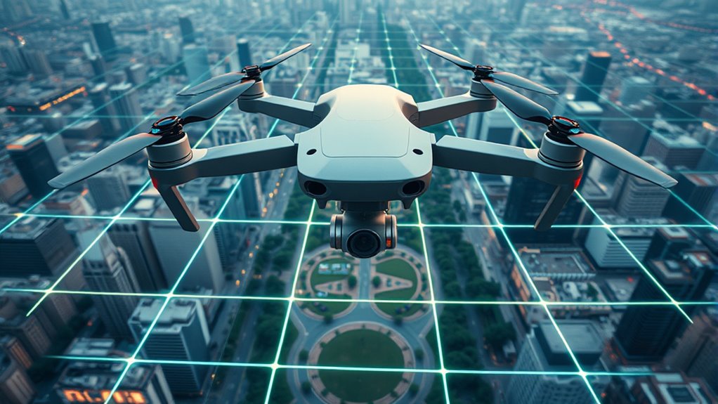
When managing drone operations for media, understanding SORA risk assessments helps you evaluate potential hazards and plan your flights safely and legally. Geofencing acts as a technological boundary, restricting drones from entering sensitive areas, which enhances safety and privacy. Combining SORA with geofencing ensures your missions stay within legal limits and protect everyone’s rights. If you want to master responsible drone use and navigate regulations confidently, exploring these tools further will give you the insights you need.
Key Takeaways
- SORA (Specific Operations Risk Assessment) helps evaluate and manage risks associated with drone missions in media operations.
- Integrating geofencing restricts drone flight zones, enhancing safety and privacy compliance during media coverage.
- SORA guides media crews in planning drone flights by assessing environmental, technical, and operational risks.
- Combining risk assessment with geofencing ensures drone activities stay within legal boundaries and designated areas.
- Responsible drone operations in media require adherence to SORA protocols and the use of geofencing technology for safety and privacy.
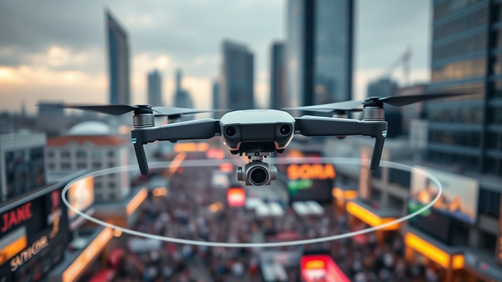
Have you ever wondered how drones are transforming media coverage? It’s quite remarkable how aerial footage captured by drones offers a fresh perspective, bringing viewers closer to events from angles previously impossible or too risky to access. Journalists and media outlets now harness drone technology to deliver stunning visuals that enhance storytelling. Whether it’s capturing a natural disaster’s aftermath, covering a large-scale event, or providing real-time updates from hard-to-reach locations, drones have become invaluable tools. However, with their increasing popularity, concerns about privacy have also grown. People worry that drone flights might infringe on personal privacy, capturing images or videos of private properties or individuals without consent. This tension between innovation and privacy rights demands responsible drone operations, especially in media contexts where sensitive subjects may be involved.
Understanding the basics of drone regulations, such as SORA (Specific Operations Risk Assessment), is essential for media professionals. SORA is a framework designed to help drone operators evaluate and manage risks associated with specific drone missions, particularly in complex environments. It ensures that drone flights are conducted safely, minimizing potential disruptions or accidents. By applying SORA principles, media organizations can plan missions that respect both safety protocols and legal boundaries, avoiding unnecessary conflicts with authorities or the public. This process often involves evaluating the environment, the drone’s capabilities, and the purpose of the flight, which helps in determining the necessary safety measures and operational constraints. When combined with good planning, SORA allows media crews to deploy drones efficiently without compromising safety or privacy. Additionally, integrating risk assessment techniques like SORA into planning processes helps organizations proactively address potential issues before flight.

Loolinn | Drones for Kids Gift, Drone with Camera – Optical Flow Positioning Technology, 60 Minutes Long Flight Time, 3 Batteries, Stable Flight – Gift for Kids Boys Girls
🎁【Intelligent Hover Technology】:There is an optical flow positioning sensor on the underside. It allows the drone to automatically…
As an affiliate, we earn on qualifying purchases.
As an affiliate, we earn on qualifying purchases.
Frequently Asked Questions
How Do I Update My Drone’s Geofencing Settings?
To update your drone’s geofencing settings, first verify your drone firmware is up to date, as this often includes the latest geofencing updates. Then, access the drone’s app or software and navigate to the safety or settings menu. Look for geofencing options, and follow the prompts to modify or update the geofence boundaries. Regularly check for geofencing updates to stay compliant with regulations and enhance flight safety.
What Are the Legal Requirements for Drone Media Operations?
You need to guarantee legal compliance by following your country’s drone regulations, which often include licensing requirements and operational restrictions. Obtain necessary permissions or certifications before flying, especially in restricted areas or near people. Keep your drone within legal limits, and always stay updated on local laws. This way, your media operations remain lawful, safe, and responsible, avoiding fines or penalties while maintaining professionalism.
Can SORA Be Integrated With Existing Drone Management Systems?
Yes, SORA can be integrated with your existing drone management systems. You should check the system integration capabilities and software compatibility to guarantee smooth operation. Most modern platforms support API connections or SDKs, making it easier to incorporate SORA’s features. By doing this, you enhance your drone operations’ safety and compliance, leveraging SORA’s regulatory insights alongside your current tools for a more efficient media drone management process.
How Does Weather Impact Geofencing Accuracy?
Ironically, weather effects can really mess with geofencing accuracy, making it less reliable just when you need it most. Rain, snow, or fog cause GPS interference, pushing your drone outside designated zones or triggering false alerts. Wind and storms can also jostle your drone, disrupting signals. So, when the weather turns nasty, expect your geofencing system to struggle, emphasizing how nature’s unpredictability can sabotage your precise drone operations.
Are There Specific Training Programs for Drone Media Operators?
Yes, there are specific training programs for drone media operators that focus on drone safety and obtaining flight certification. These programs teach you essential skills, including safe flight practices, understanding regulations, and operating within geofenced areas. Completing such training guarantees you meet industry standards, enhances your safety awareness, and helps you navigate complex environments confidently, making you a responsible and certified drone media operator.

DJI Mini 3 With DJI RC, 3-Axis Mechanical Gimbal Mini Camera Drone
No Registration Needed – Under 249 g, FAA Registration, and Remote ID are not required if you fly…
As an affiliate, we earn on qualifying purchases.
As an affiliate, we earn on qualifying purchases.
Conclusion
As you navigate drone operations for media, you’ll notice that understanding geofencing and SORA isn’t just technical—it’s a game-changer. Just like how a well-timed shot captures a perfect moment, mastering these tools keeps your flights safe and on point. So, next time you take to the skies, remember that the right knowledge often appears just when you need it—like a coincidence that turns into your secret weapon for smooth, successful drone adventures.
iMusk 8 pcs of DJI Mini 3/4/5 Pro Disassembly Kit with T5/T4 Screwdrivers, Tweezers and Opening Repair Tools
【Full Set Tools】These are all repair tools you may need to disassemble your Mini 3 Pro, DJI Mini…
As an affiliate, we earn on qualifying purchases.
As an affiliate, we earn on qualifying purchases.

HeiyRC Propeller Guard for DJI FPV Drone, Props Protector Anti-Collision Bumper Blades Protective Accessories
【Compatibility】Compatible with DJI FPV drone.
As an affiliate, we earn on qualifying purchases.
As an affiliate, we earn on qualifying purchases.